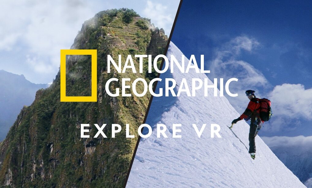
Head to Antarctica and set off on a thrilling expedition of discovery. […] Visit Machu Picchu, Peru and get immersed in amazing digital reconstructions of the ancient Inca citadel. […] With a mission to capture photographs for the National Geographic magazine, this interactive experience lets the entire family discover the world without ever leaving home.
From the product description of National Geographic Explore VR
About National Geographic
We’ve all seen the magazines and probably watched some of the documentaries. National Geographic is that amazing publication to learn more about our world and beyond. In addition to their amazing articles, their photography wins award after award, and it’s considered a crowning achievement to work for them.
For an app like this, they could have gone with the virtual visits alone. I expected to walk around areas and see amazing reconstructions of two amazing sites. I was impressed that they took a different approach and used the angle of being a photographer for the publication. Other apps incorporate the camera dynamic, but none as deeply as they’ve done here. Read on to see how well they’ve integrated photography with exploration and see if it lives up to the reputation of National Geographic.
About National Geographic Explore VR
You begin your adventure from your cool apartment (as with most adventures). This isn’t anything like where I live, but surely some people live off of the ocean with amazing views like this. The place itself is a great home base and fun to walk around in even before choosing a location. It would have been a cool idea for them to make it available as an Oculus home environment (like the included Classic Home or Winter Lodge). It’s got a cozy living area, a photo wall, and a spot to choose your destination.
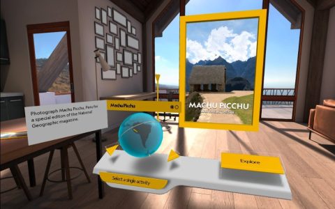
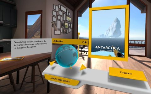
When you’re ready to make that choice, you stand in a highlighted circle on the floor, and you’ll get a globe and a very brief write-up for the two spots. For each spot, you get the iconic, yellow-bordered panel with the name of the spot and a representative photo, except that the panel is giant. It’s basically floor-to-ceiling and acts like a portal. When you’re ready, pound that Explore button to be transported!
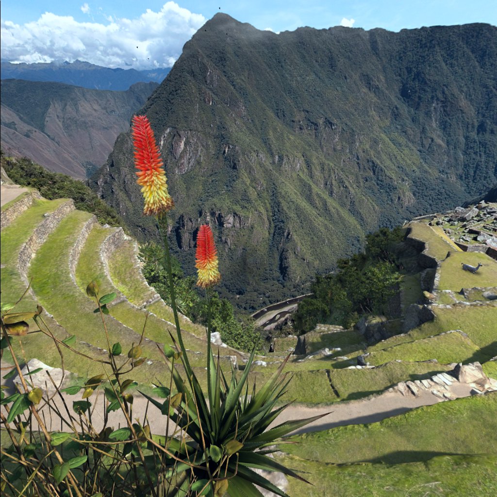
Machu Picchu
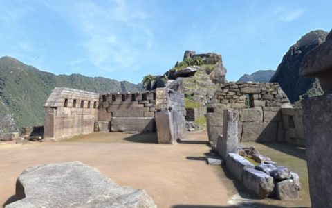
Machu Picchu has you walking around the mountain top seeing the ruins of the ancient site. As with both locations, you teleport to move, and the narrator guides you around. In 1911, Hiram Bingham made public the existence of an overgrown Machu Picchu to the wider world. He took many photos as part of his expedition. This quest lets you explore the site while taking photos similar to what he took. It’s a fun jaunt and you also get to see alpacas grazing in the grass near you.
Antarctica
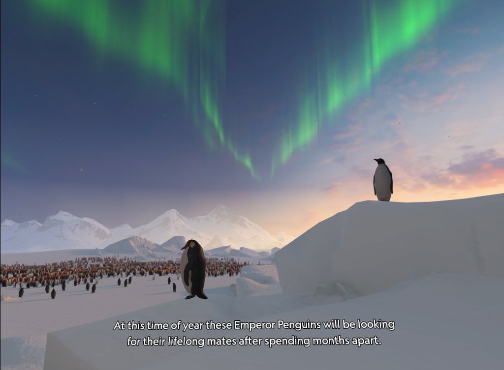
In Antarctica, you arrive by research vessel, have a kayak lowered down, then make your way toward a penguin colony. Along the way, you see a variety of creatures on land, in the sea, and in the air. They all move around fairly naturally, call out, and make for a fun backdrop. Once you get as far as you can in the water, you take pickaxes and start climbing a vertical ice sheet. I’m pretty sure that this will be the only way to do this!
At the top, a storm starts up. You fix your tent down, rummage around some storage chests, and sleep in your tent. The next day, with any luck, you’ll locate the penguin colony and get airlifted out in a helicopter. It sounds like a pretty great time!
Graphics and Sound
I expected nicely done graphics from the likes of National Geographic and thankfully they did not disappoint. The Machu Picchu location was captured photogrametrically so it’s about as close to real as it gets. As you get to the edge of the plateau, you can see that the mountains and valleys of the surrounding region are part of a giant 360° photo, but since you can’t get closer to it, the flatness doesn’t really break the immersion.
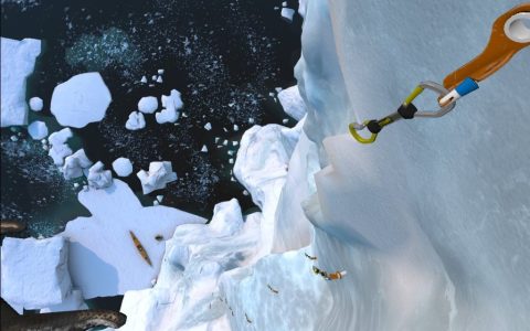
Antarctica is a different matter. I think at some point they likely decided that it didn’t make much sense to use the same technique to bring it to life. The ice flows and the glaciers break apart so it’s a very dynamic environment. Instead of capturing it all with a camera they decided to build it up from 3d shapes. It definitely shows in some places, but it’s really not a bad effect. Real ice has a translucence to it which doesn’t capture very well with static photos, so this was the right choice.
Sound effects are done well. In Antarctica, you hear the calls of the various penguins, seals, whales, and more. As you dig into the ice to climb it makes cracking noises. Your paddles splash as they hit the surface of the water. It all works well to provide immersion.
Animals
The animations of the animals are mostly very good too. The birds fly around, the penguins walk, and the whales glide through the water. In Machu Picchu there’s a lizard that crawls convincingly on a wall. Most of the animals move well, although I noticed a few motions that repeated unnaturally (for example, a penguin stretching its wings or turning its head the same way). Capturing the movement of real animals can be challenging for developers, although there are libraries of motion available (just like libraries of clip art, 3d objects, and sound effects). Whichever method they used looks good as long as you don’t watch them for too long.
Simulating water
Water is often difficult to get right in computer graphics. Often an environment will be convincing until you reach a body of water. Water may look too much like still glass or will move in a repetitive way that isn’t fooling anyone. Considering that the Antarctica experience has you sitting in a kayak, they needed to do a good job. Fortunately, I was impressed by their efforts. Not only was the surface nicely done visually, but you could also see below to catch glimpses of various animals swimming by, and there were pieces of ice floating naturally.
Information
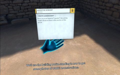
It’s definitely not a documentary, but there are facts sprinkled in with the photo missions. For example, telling you that the Incas used a given figure in a certain way as part of telling you to stage it for an in-game photograph.
In other parts, the narrator is just speaking about things around you and describing what you are seeing. This could have been made better by visually highlighting features around you but saying that something is “to your left” works well enough. I expected National Geographic to contribute more information, maybe even their famous charts and maps, but for whatever reason they chose not to lean into the educational opportunities here. Perhaps in a future update?
Interactivity
Interactivity is often missing in exploration apps, but they decided to go a different direction here and really embrace the idea of you being an active participant. I liked that, although it would have been nice if there was also a more open exploration mode.
In Machu Picchu, you place two statues in various places to photograph them. In Antarctica, there’s the camera, kayak, ice climbing, and camping.
Camera
The primary conceit with this experience is that of you being a new photographer for the world-famous National Geographic magazine. To that end, each of the two locations have missions relating to taking photos.
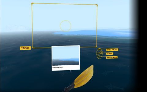
You use the camera by picking it up from your waist or the kayak, then holding it up to your face (well, your controller at any rate). Then, guidelines appear to indicate what will be in the picture. You have the choice between portrait or landscape mode (just rotate the camera in your hand), or you can switch to a panoramic mode for a wider field of view. In addition to framing, you can zoom in or out to capture just the region of detail you’re interested in. It feels pretty natural.
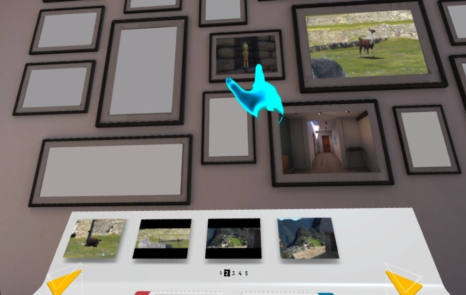
When you return to your home, there’s a wall of picture frames where you can scroll through your photos and choose which ones to display. There’s an option to share images on Facebook, but I didn’t try that so I’m not sure how well it works. You can also delete any second-tier shots from this interface.
Kayak
With Antarctica, you arrive via research vessel and a kayak is lowered down into the water for you. You can choose between seated or standing mode. I only tried seated, where it required me to actually sit on the floor. Presumably the “standing” mode would have allowed sitting off the floor in a chair in addition to actually standing. It’s good to provide options here so different abilities don’t get in the way of having fun.
Once in the kayak, you have a paddle mounted in front of you with your camera stowed beneath it. You can grab the camera at any time to take pictures and not worry about dropping it into the water as it always returns to its spot. Use both hands to hold the paddle and dip the ends into the water one side at a time. Just like with real kayaking, you’ll need to focus on one side when you’re trying to angle a specific direction. You won’t feel like you’re about to get wet, but it’s a decent experience.
Even though there is a choice between sitting and standing, I wonder about those who might have trouble with the paddling motions. I’m not sure if there are any other options that would make allowances for limited arm motion.
Climbing and Camping
At the end of the kayak ride, you end up on a bank with a sheer ice cliff in front of you. Now you trade your paddle for two ice picks. You alternate pounding each one into the ice so you can pull yourself up. Fortunately, you don’t have the real concern about digging your crampons in place (your spiked boots) or anchoring your carabiners. I don’t think I’ll ever try ice climbing as it’s not my thing (hey, I’ve been sky diving!), but it’s fun to get some basic feel for it in VR
At the top, you need to get to your tent and tether some straps to the ground to protect it from flying away, find your sleeping back in a chest outside, and move some other chests around for a better windbreak. They’re all relatively easy tasks to complete, but help to flesh out the adventure.
Future Potential
Like Holotour, this seems like a natural fit to add content over time. I’m assuming it didn’t sell as well as they thought it would, but since it’s been on the scene for a few years it may look like an old title that’s not worth it. I’d love to see more locations/missions released for this.
Summary
Pros
- Great graphics
- Fun photographic challenges
- Good use of National Geographic name
Cons
- Only two locations
- Kayak and ice climbing could be challenging depending on physical abilities
- I’d love to have a more open-world exploration mode as well
All in all, this is a great app! It’s a bit expensive ($10 at time of purchase), but not out of line. I would love to see them develop it into a platform for additional locations, even if there was a small in-app purchase for additions. As mentioned, I think they could do more with the educational side of things given the wealth of articles and data they’ve collected over the decades, but it’s a really well-done experience and fun for all ages. If you want to see how well you’d do as a National Geographic photographer, this is your chance!

